What to See along Route F26 in Iceland’s Highlands
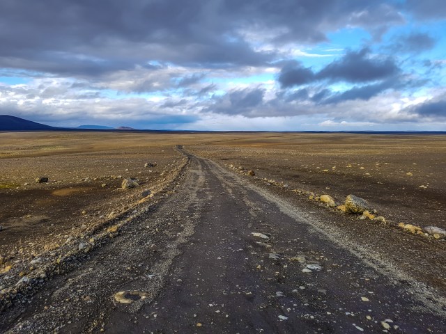
Black lava, gigantic boulders, and towering mountains await along Route F26, also known as Sprengisandur, though Iceland’s highlands. Visitors travel to this region to check out what is essentially an arctic desert. It’s dry and barren, with its water trapped in the glaciers. Iceland’s summer is warm enough for significant melting. From lava fields to ice caves, here are the sights you won’t want to miss.
Trölladyngja
Route F910, GPS coordinates N 64.8931, W 17.2547
Trölladyngja (Troll’s Volcano) is the largest shield volcano, a domed volcano comprising fluid lava flows, in the country, and connects the Grimsvötn and Bárðarbunga central volcanoes. Mount Trölladyngja (1,468 m/4,817 ft) is still active and only viewable from the road. It’s 10 km (6.2 mi) in diameter with a 100-m (328-ft) crater on top. Lava flows from it in all directions, especially to the north and west. The Gæsavötn Route F910 passes through the north of it.
Ódáðahraun
Route F88
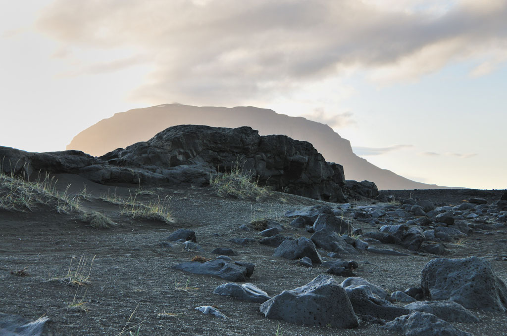
Ódáðahraun (Crime Lava Field) is not only the largest lava field in Iceland, it’s the largest desert in Europe, spanning more than 6,000 sq km (2,317 sq mi). Black, brown, and gray colors dominate the landscape. Visitors to the area will see endless sand, vast expanses of lava, and interesting geological formations caused by volcanic activity over the centuries. The lava shapes range from flat and smooth to rough and jagged. The region garnered its name, “crime lava,” based on lore that numerous criminals hid out in the area trying to elude the authorities. The wind blows strongly, and there always seems to be a chill in the air. The isolation can be overwhelming—it’s an eerie place to visit, though great for roaming and taking photos. Route F88 takes you to Ódáðahraun.
Laugafell
Route F821, GPS coordinates N 65.0278, W 18.3319
Laugafell (Bath Mountain) is situated northeast of the Hofsjökull glacier, about 20 km (12 mi) southwest from the end of the Eyjafjarðardalur valley. It’s a special place in the vast barren stretch of the highlands, with the spectacular 879-m (2,884-ft) mountain adjacent to a geothermal hot spot. Two hot springs (free) open to visitors are in the northwestern portion of the mountain, and patches of grass and plants among the bubbling pools make it a desert oasis. It is important to have a good map for this region to find the hot springs and trails. Three mountain huts (www.fi.is; rooms from 17,000ISK) are open during the summer; they have cooking facilities, and guests can access a geothermal nature pool. Laugafell and the region are accessible by Route F821.
Askja
Route F88
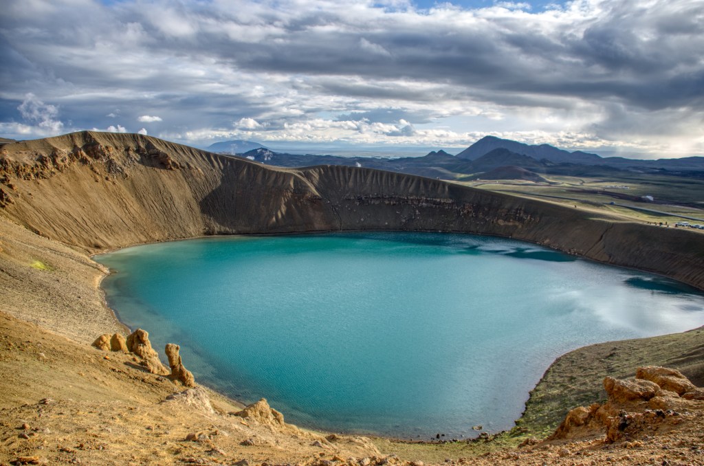
Askja is a caldera in the remote, awe-inspiring Dyngjufjöll Mountains. Essentially huge volcanic craters, calderas are formed by land collapsing after a volcanic eruption. At 1,516 m (4,984 ft), Askja emerges from the Ódáðahraun lava field, and the terrain is quite rocky. Víti is a tremendous pale-blue lake-filled crater that emerged after the great eruption of the Askja volcano in 1875. It’s possible to take a dip in the water, which reaches a temperature of about 30°C (86°F).
Askja is one of the most popular destinations in the highlands. There are two mountain huts (the Dreki huts, www.ffa.is) on Route F88, about 100 km (62 mi) from the Ring Road. From there, it’s an 8-km (5-mi) drive up into the Askja caldera. It is a walk of about 2.5 km (1.6 mi) from the car park to Víti. Remember that the roads are usually only open for about three months, late June-September. Depending on the weather, the open period could be longer or shorter.
Hiking Mount Askja
Distance: 11.5 km (7.1 mi) round-trip; Hiking Time: 2 hours; Information and Maps: www.visiticeland.is; Trailhead: Car park (GPS coordinates N 65.0140, W 16.4500), which can be reached by Route 1 to Route F88
Passionate hikers will want to walk the rim of Askja. It offers some slopes and ultra-rocky terrain along with spectacular views of lava fields, mountains, and the mighty Víti crater. It’s about a 30-minute moderate hike, 2.5 km (1.6 mi) one-way, from the car park up to the caldera. The landscape is punishing, and devoid of vegetation, but the muted colors of brown and gray are striking against spots of snow and the blue water in the crater. The highest point in Askja is 1,516 m (4,974 ft). The rim is about 6.5 km (4 mi) around, which takes about an hour to walk. If you are not planning to hike the rim, you can just explore near the car park. To reach the car park, take Route 1 to Route F88.
While the trail is well maintained, the main challenge is weather. If the forecast calls for wind, it’s best to skip the planned hike. Do not underestimate the power of Iceland’s wind, especially in the highlands.
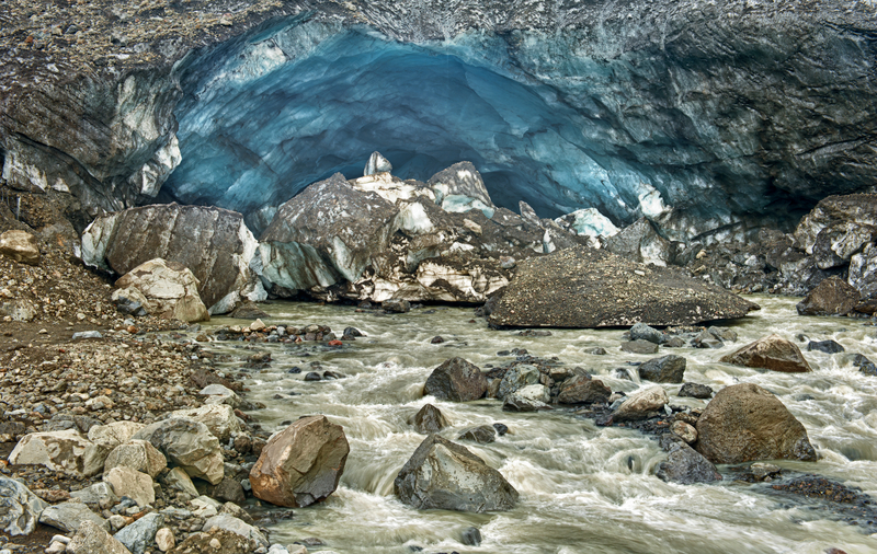
Kverkfjöll
Route F910 to Route F902, GPS coordinates N 64.7475, W 16.6315
Reaching 1,764 m (5,788 ft), the Kverkfjöll volcano includes two calderas that are filled with ice. The area is striking for its range of colors, with a deep black background that gives way to gorgeous blues and icy white. The main attractions are the ice caves that were created by hot springs, slowly melting the ice into interesting shapes. Stay safe, however, and observe the caves from the outside; you never know when the ice mass could give way. To get to Kverkfjöll, take Route F910 southeast to Route F902.
Exploring more of Iceland’s highlands?
Featured Post
Newsletter Signup
By clicking ‘Sign Up,’ I acknowledge that I have read and agree to Hachette Book Group’s Privacy Policy and Terms of Use
Pin It for Later